

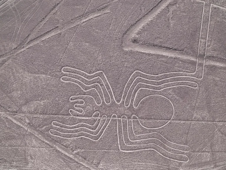

Across the hyper-arid coastal plateau of southern Peru, wedged between the frigid Pacific Ocean and the western foothills of the Andes, lies humanity’s most magnificent open-air canvas. Thousands of gigantic biomorphs — including spiders, hummingbirds, monkeys, and orcas — alongside monumental trapezoids and multi-kilometer straight lines are etched into the oxidized desert floor. But why were the Nazca Lines built (Nazca Lines) by ancient civilizations two millennia ago without aerial technology or modern survey instruments? Over the past century, hypotheses have ranged from prehistoric alien runways and sprawling astronomical calendars to caravan trail markers and sacred fertility labyrinths. Today, by synthesizing satellite remote sensing, artificial intelligence, and systematic excavation of ceremonial rock mounds, researchers have finally established an evidence-based consensus on this enduring archaeological enigma.
From Alien Runways to Rigorous Science: A Century of Desert Exploration
Covering more than 450 square kilometers of hyper-arid gravel plains in southern Peru, the Nazca geoglyphs escaped formal documentation until the late 1920s. Peruvian archaeologist Toribio Mejía Xesspe first noticed shallow grooves while hiking regional hillsides, initially interpreting them as sacred Andean roads (ceques). It was only with the advent of commercial aviation that travelers looking down from airplanes realized the true grandeur of the hummingbirds, monkeys, condors, and spiders carved into the earth.
In the mid-20th century, sensationalist writers popularized the notion that the broad trapezoids were landing strips for extraterrestrial craft. Mainstream archaeology swiftly dismantled these claims by demonstrating that the construction technique was extraordinarily elegant yet technologically simple. Pre-Columbian builders manually removed surface gravel darkened by desert varnish, piling it along borders to expose the pale chalky subsoil. Surveying relied on simple wooden stakes and cords, samples of which have provided definitive radiocarbon dates.
Today, exploration is propelled by high-resolution satellite imagery and deep-learning algorithms, mirroring how advanced geodetic surveys examine ancient archaeological complexes around the globe.
The Astronomical Calendar Hypothesis: Maria Reiche’s Legacy Tested
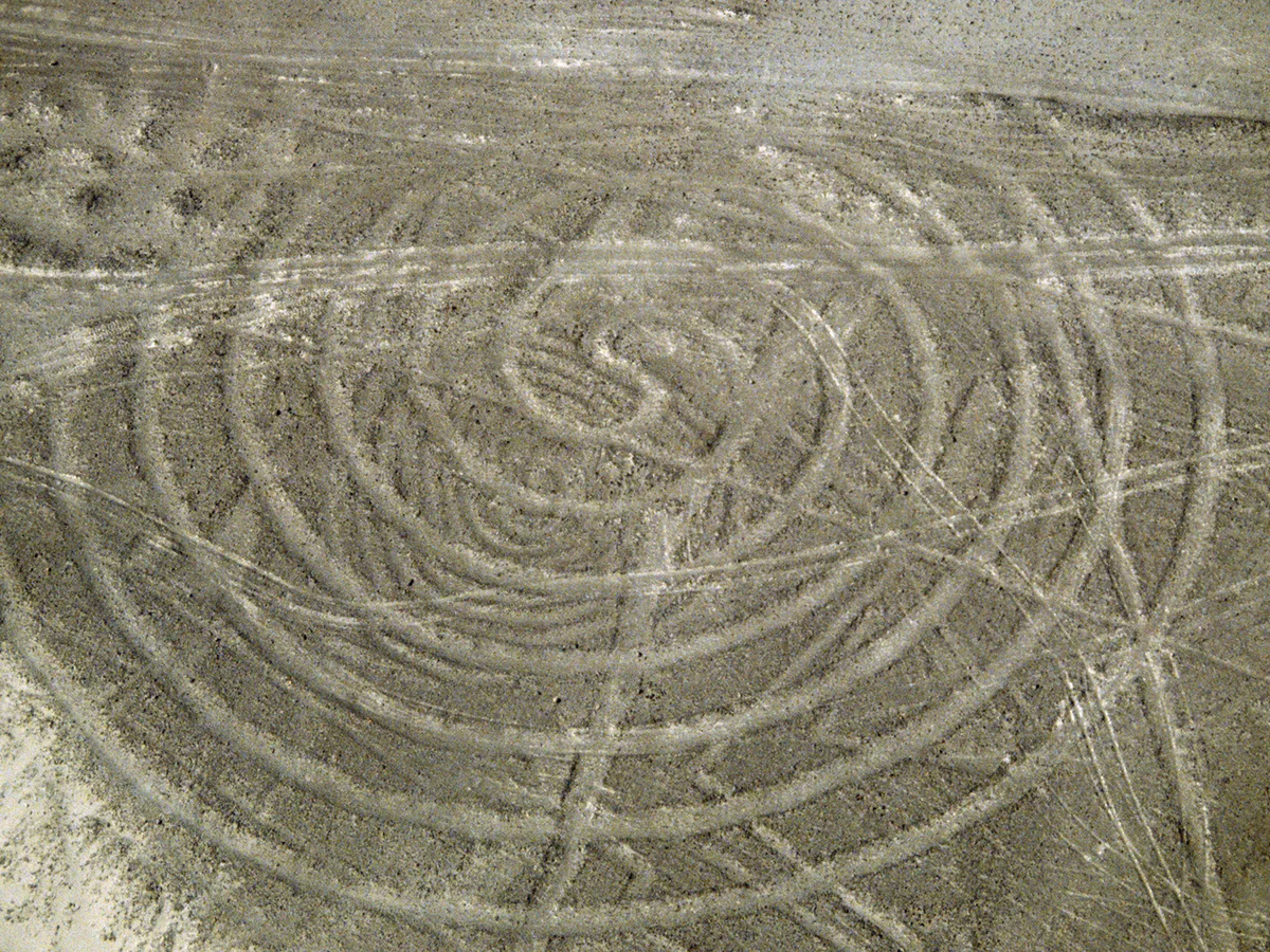
The first systematic scientific framework was proposed by American historian Paul Kosok, who observed on the winter solstice of 1941 that the setting sun aligned precisely with the axis of a straight line. German mathematician Maria Reiche dedicated over forty years to living in the desert, sweeping the lines and recording alignments. Reiche posited that the pampa served as an enormous astronomical observatory and agricultural calendar where animals represented celestial constellations.
However, modern computational analysis led by researcher Christiane Richter at the University of Applied Sciences in Germany introduced rigorous statistical rigor. Simulating thousands of line azimuths against stellar and planetary positions over centuries, Richter’s team demonstrated that the geoglyphs as a whole cannot be interpreted as a unified calendar.
Nonetheless, Richter discovered that approximately 8% of the analyzed lines show statistically significant alignments with solstices and lunar standstill extremes. Celestial phenomena clearly played a selective role in framing ceremonial timelines, though they formed only one layer of a multifaceted cultural landscape.
The earliest hillside Paracas geoglyphs functioned as navigational beacons, marking travel routes and water sources for llama caravans.
In extreme aridity, geoglyphs served as ceremonial stages where priests offered Spondylus shells, maize, and ceramics to plead for rainfall.
Recent astrophysical modeling confirmed that approximately 8% of the lines exhibit deliberate alignments to solstices and lunar cycles.
Biomorphic geoglyphs were designed with continuous, unbroken lines, enabling communal processions that reinforced egalitarian social solidarity.
Functional Evolution: From Caravan Beacons to Sacred Processional Paths
Ana Nieves, Professor of Art History at Northeastern Illinois University, emphasizes that the Nazca Lines were not built in a single era or for a single purpose. The earliest geoglyphs, etched by the Paracas culture around 400 BCE, were placed on hillsides where they were easily visible to travelers on the ground.
Recent studies published in 2026 indicate that these hillside drawings marked vital travel corridors between highland valleys and the Pacific coast, signaling water caches and resting camps for llama caravans. Over centuries, as societal complexity deepened under the Nazca culture, geoglyphs transitioned from utilitarian slope markers onto the flat desert floor.
Crucially, biomorphic figures were constructed using a single, continuous line that never crosses itself. Rather than visual art meant for airborne viewing, these were processional paths. Pilgrims walked single-file along the lines during sacred seasonal dances, transforming the act of walking into a kinetic ritual.
«The question of why the geoglyphs exist is difficult to answer, given that we lack any type of preserved oral or written testimony. Yet close examination reveals diverse styles, varied scales, and evolving locations from hillsides to open pampas. It is highly improbable that a single explanation applies to all of them; their meanings undoubtedly evolved across centuries.»
Karsten Lambers, Professor of Art History at the University of Augsburg, Germany
Water Cults, Spondylus Offerings, and Social Egalitarianism
The definitive evidence unlocking the spiritual core of Nazca comes from archaeological excavations within stone cairns and low platforms flanking the trapezoids. Excavations directed by Karsten Lambers of the University of Augsburg uncovered deliberate offerings: smashed polychrome ceramics depicting agricultural fruits, crab claws, and marine shell ornaments made from Spondylus (thorny oyster).
Spondylus shells do not thrive in cold Peruvian coastal currents; their native habitat lies hundreds of miles north in warm Ecuadorian waters. They only migrate south during major El Niño events, which bring torrential rains to hyper-arid coastal deserts. For Nazca farmers living on the edge of survival, Spondylus shells were the supreme symbol of life-giving water and fertility.
Darryl Wilkinson, Professor of Religion at Dartmouth University, highlights that participating in line-walking processions fostered communal equality among dispersed agrarian clans. By mobilizing entire populations in communal geoglyph construction and pilgrimage, the people of Nazca transformed an inhospitable desert into a sacred theater of resilience and solidarity.
- Construction technique: scraping away the sun-varnished reddish iron-oxide gravel to reveal the light-colored gypsiferous subsoil beneath.
- Cultural chronology: initial figurals created by the Paracas culture (c. 400 BCE), followed by monumental geometric lines of the Nazca culture (100 BCE – 650 CE).
- Scale: over 1,000 biomorphic and phytomorphic depictions and more than 10,000 linear trapezoids, with hundreds of new figures discovered via neural network models.
- Hyper-arid preservation: stable year-round temperatures, near-total absence of rainfall, and lack of ground winds preserved the etchings for 2,000 years.
- Climatic correlation: archaeological deposits of exotic Spondylus shells coincide historically with torrential El Niño weather anomalies.