



Beneath the turbulent, gray swells of the modern North Sea lies the submerged cradle of prehistoric Northwestern Europe—Doggerland, a vast, fertile continental landmass that once connected Britain directly to mainland Europe. Groundbreaking discoveries from the University of Bradford’s Lost Frontiers project, utilizing high-resolution 3D seismic bathymetry and ancient sedimentary DNA (sedDNA), are resurrecting the epic saga and cataclysmic demise of this Mesolithic heartland, ultimately drowned by post-glacial sea-level rise and the colossal Storegga tsunami.

The Hidden Continent Beneath the Gray North Sea
When surveying the contemporary political geography of Northwestern Europe, Great Britain appears fundamentally characterized by its insular geography, isolated from France, the Low Countries, and Scandinavia by the English Channel and the North Sea. Yet, across the broad horizons of Quaternary geology, Britain’s island status is an astonishingly recent anomaly. Less than ten millennia ago, the geographical space now occupied by the North Sea was dry land: an undulating, fertile continental realm spanning hundreds of thousands of square kilometers, designated by geoscientists and archaeologists as “Doggerland” (honoring the Dogger Bank, an extensive shallow sandbank in the heart of the sea).
Doggerland represented the genuine demographic and ecological heart of early Holocene Europe. Far from a frozen, inhospitable tundra strip, it featured a massive hydrographic drainage basin where ancient ancestral incarnations of the Thames, the Rhine, the Meuse, and the Elbe converged into a majestic primeval river system. The landscape comprised lush riparian marshes, freshwater lakes teeming with pike and migratory waterfowl, and rolling uplands carpeted with deciduous birch, pine, hazel, and oak forests. For populations of Mesolithic hunter-gatherers, Doggerland was an unparalleled paradise of terrestrial and aquatic foraging. The study of past environmental shifts and human societal adaptation provides crucial historical context: as previously explored on Vinegret.Net in our report on advanced computational models and environmental reconstruction, cutting-edge analytics allow researchers to reconstruct lost worlds with exquisite fidelity.
Trawling for Prehistory: Mammoth Tusks and Bone Harpoons
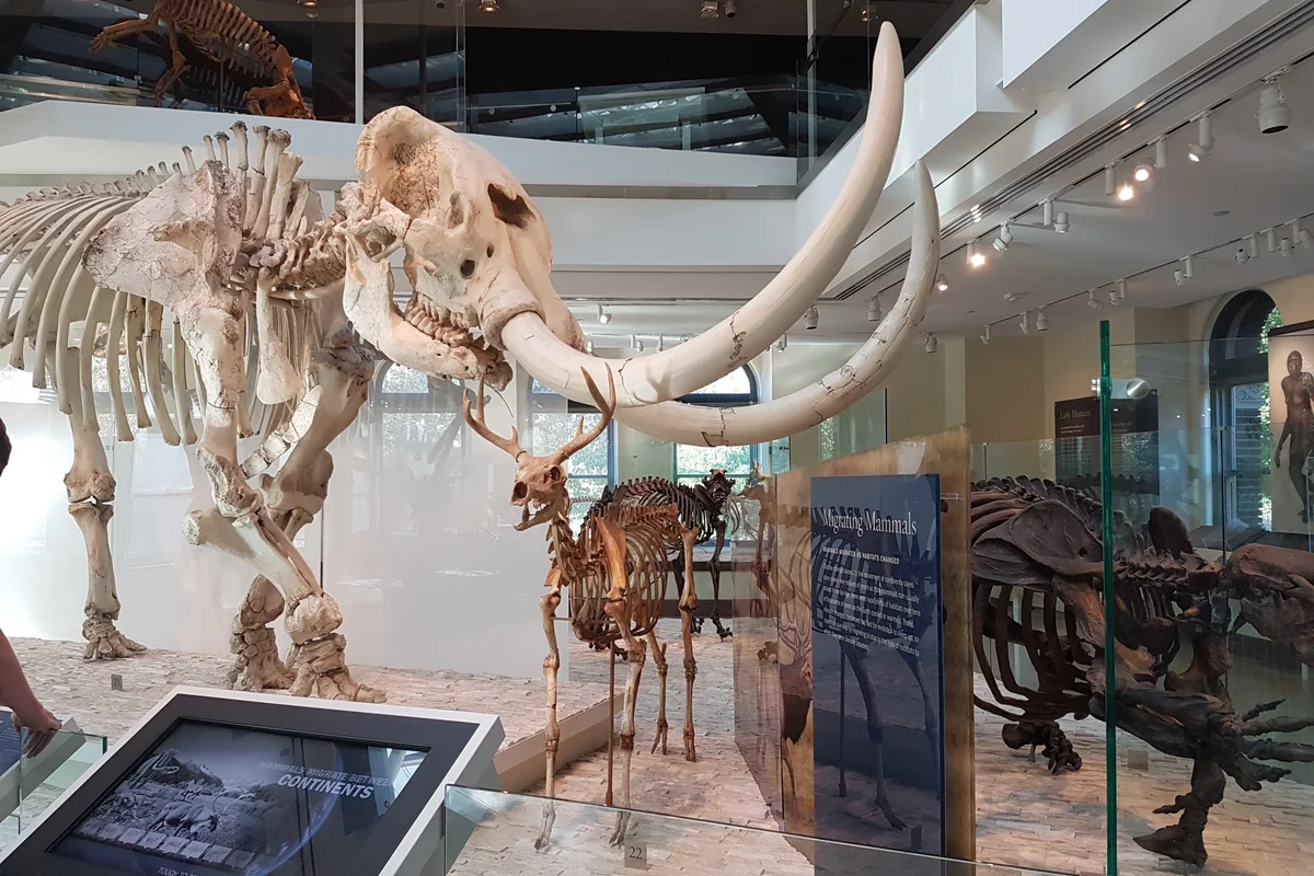
For more than a century, the enigma of Doggerland surfaced not through academic excavations, but in the heavy, industrial trawl nets of Dutch and British fishing fleets. Plying the shallow waters of the Dogger Bank for cod, plaice, and herring, fishermen routinely dragged up perplexing, heavy debris from depths of 20 to 40 meters: massive fossilized mammoth molars, woolly rhinoceros limb bones, reindeer antlers, and petrified peat deposits locally known as “moorlog.”
The turning point in recognizing Doggerland as an inhabited archaeological landscape occurred in September 1931. While trawling twenty-five miles off the Norfolk coast, the crew of the trawler Colinda dredged up a lump of dense moorlog. Inside, preserved in immaculate detail by the oxygen-free, waterlogged silt, was a barbed, finely carved bone point measuring 21.6 centimeters in length, designed for spear-fishing. Subsequent radiocarbon dating firmly placed the artifact in the early Mesolithic, approximately 9,200 BCE. The discovery proved indisputably that the North Sea floor was not merely a sunken graveyard of Ice Age megafauna, but an inundated homeland of prehistoric human communities.
Project Lost Frontiers: Resurrecting a Sunken World with 3D Geophysics
In recent years, the archaeology of Doggerland has undergone a profound scientific renaissance, spearheaded by the multi-million-euro Europe’s Lost Frontiers project based at the University of Bradford and directed by pioneering geoarchaeologist Professor Vincent Gaffney. Instead of relying solely on serendipitous fishing dredge finds, Gaffney’s team partnered with multinational energy corporations, gaining access to tens of thousands of square kilometers of high-density 3D seismic reflection data originally collected for offshore oil and gas prospecting.
By computationally stripping away the water column and the modern seabed sediment blanket, the researchers reconstructed the topography of Doggerland in staggering, photorealistic three-dimensional detail. Meandering prehistoric river paleochannels, alluvial terraces, estuaries, inland lagoons, and fossil sand dunes were brought to light. Complementing seismic bathymetry, oceanographic research vessels extracted hundreds of deep sediment drill cores to harvest ancient sedimentary DNA (sedDNA). By sequencing microscopic environmental DNA trapped within the stratigraphic layers, paleobiologists detected the presence of ancient hazel trees, oak, birch, heather, wild horses, roe deer, aurochs, and wolves. This research resonates with discoveries discussed on Vinegret.Net in our coverage of ancient genetic analysis and the chemical deciphering of biological history.
A Mesolithic Hunter’s Paradise
Far from a barren land bridge, Doggerland was an expansive continental river basin with rich oak forests, marshes, and abundant mammoth steppe megafauna.
3D Seismic Ocean Floor Bathymetry
Geophysical acoustic data contributed by offshore petroleum surveys enabled archaeologists to digitally map drowned hills, river networks, and ancient coastlines.
Sedimentary Ancient DNA (sedDNA)
Deep marine core drillings retrieved fossilized DNA signatures of red deer, aurochs, wild boar, and hazel woodlands dating back over 9,000 years.
The Storegga Megatsunami Disaster
Around 6200 BCE, an underwater continental shelf collapse off Norway triggered a devastating 20-meter tsunami wave that permanently obliterated Doggerland.
The Storegga Megatsunami: Cataclysm at 6200 BCE
The inundation of Doggerland unfolded across two distinct temporal regimes: progressive eustatic sea-level rise followed by abrupt catastrophic destruction. Following the Last Glacial Maximum (c. 18,000 years ago), the melting of the immense Laurentide and Fennoscandian ice sheets unleashed billions of tons of meltwater into the global oceans. Sea levels surged at rates of up to one to two meters per century. Slowly but relentlessly, low-lying coastal marshes were converted into brackish tidal flats, the English Channel breached the chalk ridge of the Weald-Artois anticline, and Britain became progressively severed from the continental mainland.
By approximately 6200 BCE, Doggerland had been reduced to a low-lying, swampy archipelago centered around the elevated topographic plateau of the Dogger Bank. Then came an apocalyptic geophysical catastrophe: the Storegga Slide. Off the western continental shelf of Norway, an estimated 3,500 cubic kilometers of underwater sediment collapsed down the continental slope into the oceanic abyssal plain. The gravitational displacement of seawater unleashed a colossal megatsunami across the North Atlantic basin. Waves measuring 20 to 25 meters in height struck the Shetland Islands and the Scottish coastline, while a catastrophic wall of water slammed directly into the low-lying, defenseless islands of remaining Doggerland. Within hours, the surging seawater erased Mesolithic coastal camps, smothered pristine wetlands beneath meters of marine sand, and permanently sealed the fate of the sunken continent.
Modern Resonances: Climate Lessons from a Sunken World
The tragedy of Doggerland offers profound, chilling insights for 21st-century civilization. Today, over 600 million people worldwide inhabit coastal zones less than ten meters above current mean sea level. As anthropogenic greenhouse gas emissions drive accelerating thermal expansion of the oceans and ice sheet collapse in Antarctica and Greenland, coastal metropolises such as London, Amsterdam, Miami, and Shanghai face the prospect of chronic flooding and maritime retreat.
Doggerland serves as a poignant physical reminder that the geography of our planet is neither eternal nor static. When critical climatic and oceanic tipping points are crossed, coastal landscapes that supported countless generations of human culture can be erased from the map in the blink of a geological eye.
Scientific Epilogue: Reclaiming Europe’s Lost Ancestry
Thanks to the convergence of deep marine geophysics, sedDNA bioinformatics, and underwater archaeology, Doggerland is no longer relegated to the realm of folklore or romantic myth. It stands as an empirically validated testament to the resilience, adaptability, and ultimate vulnerability of human societies when confronted with the immense, primordial power of Earth’s changing climate.